Month: January 2017
Osisko Intersects 12.7 g/t Au Over 5.4 Metres At Windfall
Caribou Corridor CS1 Zone Expanded by 120 meters
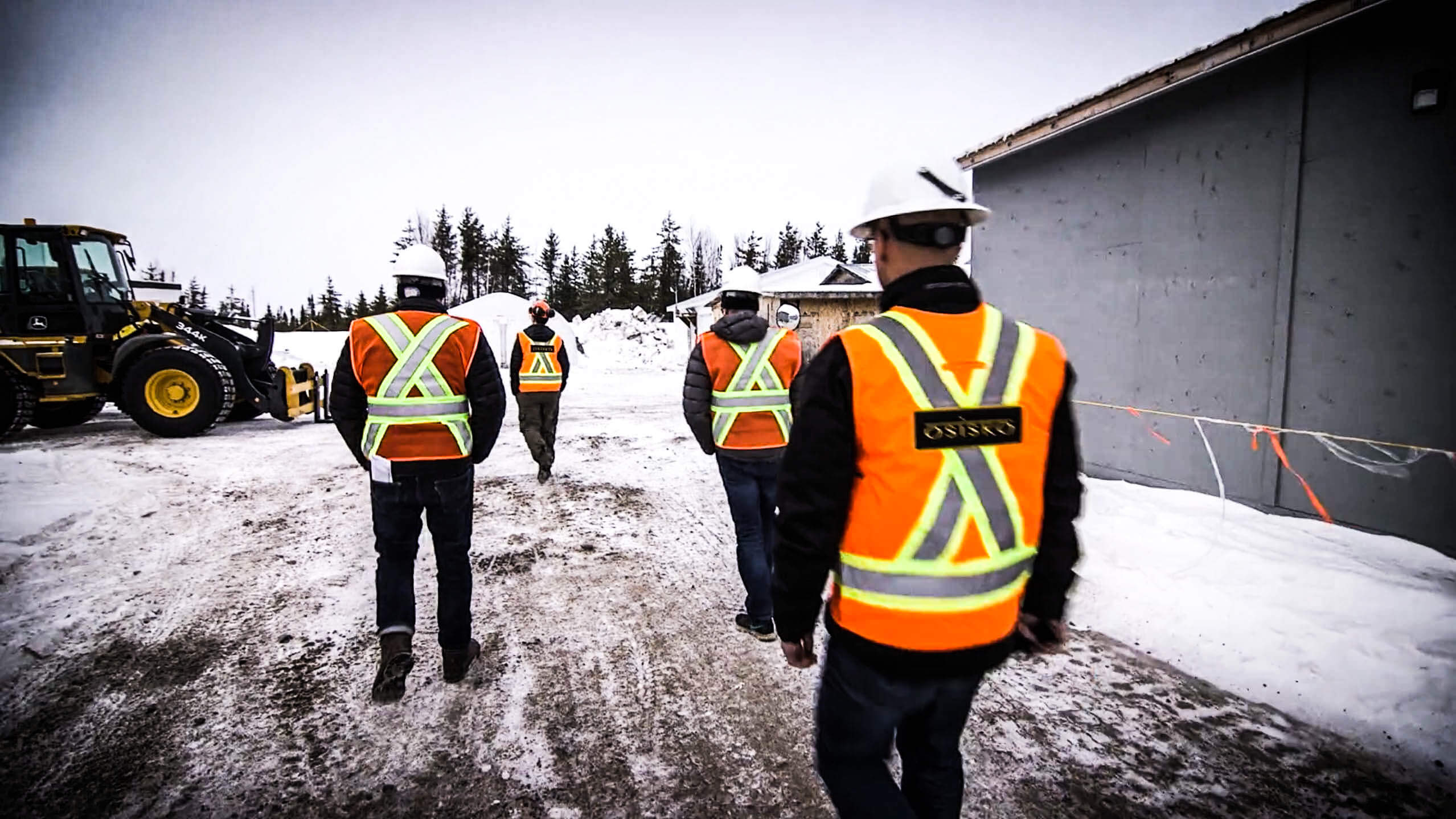
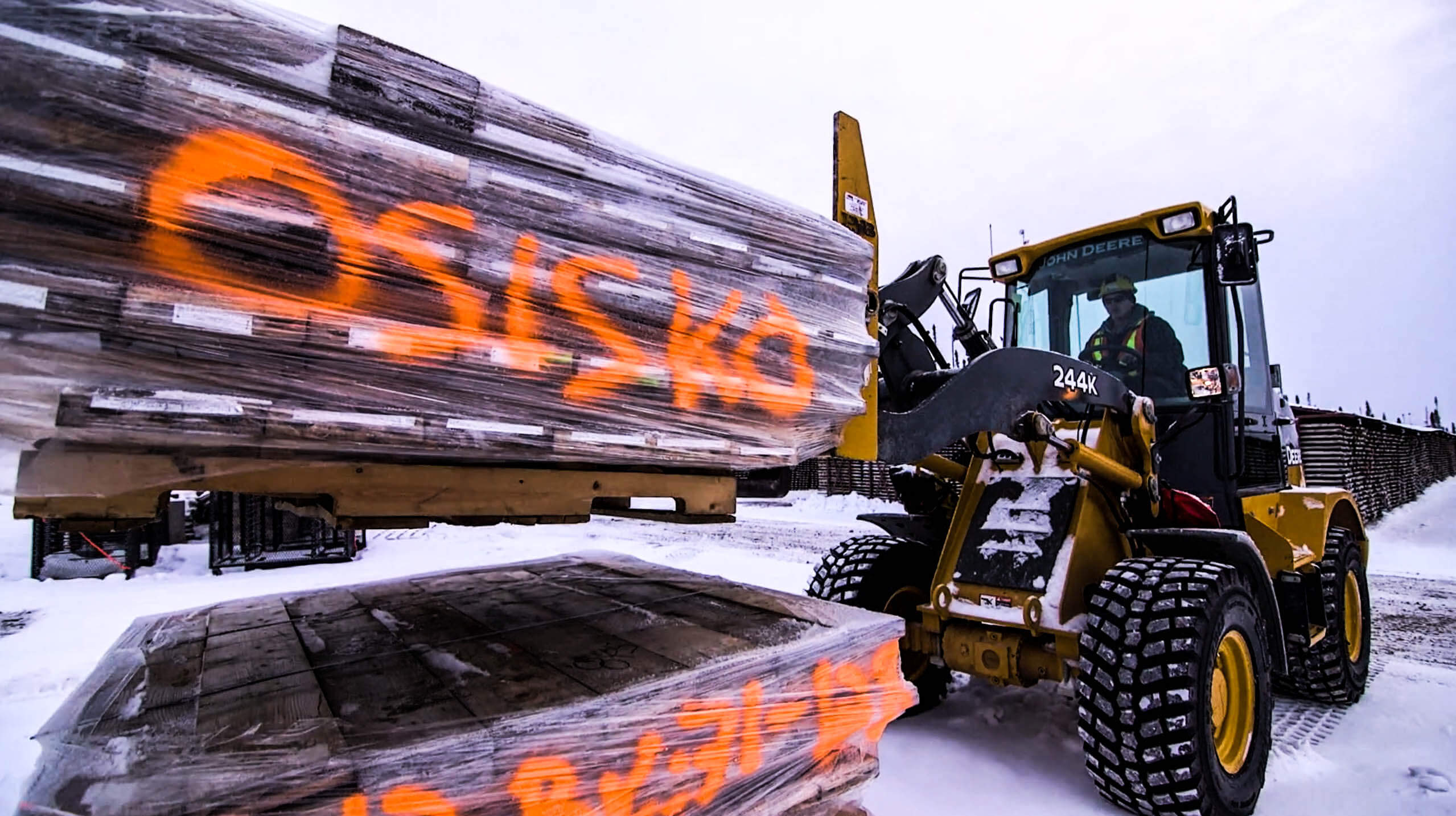
(Montréal, January 23, 2017). Osisko Mining Inc. (OSK:TSX, “Osisko” or the “Corporation”) is pleased to announce new results from the ongoing drill program at its 100% owned Windfall Lake gold project located in Urban Township, Québec. The current 400,000 metre drill program combines definition drilling above the Red Dog intrusion (“Red Dog”), expansion drilling above and below Red Dog, expansion drilling to the NE of the main deposit, and exploration drilling on the greater deposit and Urban-Barry Project area. Nine drills are currently active directly on the Windfall deposit, with additional drills planned to be added by month end. Including areas outside the main deposit, a total of 12 drills are currently active. New analytical results from five drill holes focussed on expansion and infill drilling in the Caribou and Underdog corridors are reported in this release, with significant assay results presented in the table below.
Significant new results include: 12.7 g/t Au over 5.4 metres in OSK-W-16-749 and 10.3 g/t Au over 3.0 metres in OSK-W-16-743-W2; 11.0 g/t Au over 2.4 metres and 8.13 g/t Au over 2.6 metres in OSK-W-16-743-W1. Maps and sections showing hole locations and full analytical results are available at www.osiskomining.com.
| Hole No. | From (m) |
To (m) | Interval (m) |
Au (g/t) uncut |
Zone | Corridor |
| OSK-W-16-743 W2 | 748.0 | 751.0 | 3.0 | 10.3 | CS1 | Caribou |
| including | 749.6 | 751.0 | 1.4 | 21.5 | ||
| OSK-W-16-749 | 504.6 | 510.0 | 5.4 | 12.7 | CS1 | Caribou |
| including | 504.6 | 505.3 | 0.7 | 35.2 | ||
| OSK-W-16-754 | 724.4 | 726.5 | 2.1 | 7.15 | CS1 | Caribou |
| including | 724.9 | 725.5 | 0.6 | 24.6 | ||
| OSK-W-16-756 | 672.8 | 675.4 | 2.6 | 3.29 | CS1 | Caribou |
| including | 673.8 | 674.6 | 0.8 | 9.66 | ||
| OSK-W-16-743 W1 | 1000.5 | 1005.7 | 5.2 | 5.77 | FW0 | Underdog |
| including | 1001.3 | 1003.7 | 2.4 | 11.0 | ||
| 1243.5 | 1245.6 | 2.1 | 6.77 | FW2 HW | Underdog | |
| 1251.8 | 1254.4 | 2.6 | 8.13 | FW2 | Underdog | |
| including | 1252.1 | 1252.9 | 0.8 | 24.0 | ||
| 1394.0 | 1396.0 | 2.0 | 6.29 | FW3 | Underdog | |
| including | 1394.0 | 1394.9 | 0.9 | 12.9 | ||
| 1108.0 | 1111.0 | 3.0 | 4.94 | FW0 | Underdog | |
| including | 1110.0 | 1111.0 | 1.0 | 11.9 | ||
| 1128.4 | 1131.0 | 2.6 | 3.66 | FW0 FW | Underdog |
Notes:
- True Widths are estimated at 65 – 80% of the reported core length interval. See “Quality Control” below.
- Definitions: HW = hanging wall; FW = footwall
| Hole Number | Azimuth (°) | Dip (°) | Length (m) |
UTM E | UTM N | Section |
| OSK-W-16-743 W1 | 333.3 | -64.1 | 1489.5 | 452651 | 5434237 | 2525 |
| OSK-W-16-743 W2 | 333.3 | -64.1 | 1626.7 | 452651 | 5434237 | 2525 |
| OSK-W-16-749 | 332.0 | -57.0 | 553.0 | 452486 | 5434389 | 2450 |
| OSK-W-16-754 | 331.0 | -59.1 | 1564.5 | 452766 | 5434303 | 2675 |
| OSK-W-16-756 | 331.0 | -58.0 | 803.0 | 452809 | 5434392 | 2750 |
Caribou Corridor
Four of the drill holes intersected the CS1 Zone of the Caribou Corridor, expanding it to 360 metres by 200 metres. The CS1 Zone remains open down plunge.
OSK-W-16-749 returned 12.7 g/t Au over 5.4 metres hosted in a silicified porphyry dyke containing 2% to 35% pyrite stringers and disseminations. This intercept is located 120 metres to the southwest of previously released OSK-W-16-706 which returned 8.65 g/t Au over 3.0 metres.
OSK-W-16-743-W2 intersected 10.3 g/t Au over 3.0 metres in a bleached andesite containing 5% – 20% pyrite stringers and disseminations, expanding the CS1 Zone 120 metres down-dip.
OSK-W-16-754 assayed 7.15 g/t Au over 2.1 metres in the strongly silicified and sericitized contact between a porphyry dike and andesite containing 5-20% pyrite stringers with minor visible gold. This hole expands the CS1 Zone 60 metres down-plunge from previously reported OBM-15-564 which returned 5.59 g/t Au over 7.4 metres. The hole also intersected 4.94 g/t Au over 3.0 metres in the FW0 Zone and 3.66 g/t Au over 2.6 metres in the FW0 Footwall Zone, both of which contain mineralization similar in style to that above the Red Dog.
OSK-W-16-756 intersected 3.29g/t Au over 2.6 meters and extended the CS1 Zone 60 metres northeast of previously reported OBM-15-564 (5.59 g/t Au over 7.4 meters) and 95 metres above previously reported OSK-W-16-754 (7.15 g/t Au over 2.1 metres). Mineralization comprises 15% pyrite stringers at the contact between a porphyry dike and strongly sericitized andesite.
Underdog Corridor
OSK-W-16-743-W1 targeted several parallel zones of the Underdog Corridor and intersected 5.77 g/t Au over 5.2 meters, extending the FW0 Zone by 100 metres southwest of previously reported OBM-15-560 (12.5 g/t Au over 2.0 meters). Mineralization consists of 10% to 30% pyrite stringers in a strongly silicified fragmental porphyry dike. The FW0 Zone has been intersected by eight drill holes to date and now defines an area 210 metres by 290 metres.
The hole also intersected the FW2 Zone assaying 8.13 g/t Au over 2.6 metres and extends the zone by 130 metres west of previously reported OSK-W-16-743 (47.0 g/t Au over 2.6 metres; 303.1 g/t Au over 2.6 metres uncut). Gold mineralization is hosted in a silicified porphyry dike containing semi-massive pyrite. The FW2 hanging wall returned 6.77 g/t Au over 2.1 metres in a silicified porphyry dike containing 2-5% pyrite and the FW3 Zone returned 6.29 g/t Au over 2.0 metres at the contact between felsic volcanics with 2-3% pyrite stringers and disseminations.
Qualified Person
The scientific and technical content of this news release has been reviewed, prepared and approved by Mr. Jean-Philippe Desrochers, Ph.D., P.Geo. Senior Project Manager of the Windfall Lake gold project, who is a “Qualified Person” as defined by National Instrument 43-101 – Standards of Disclosure for Mineral Projects (“NI 43-101”).
Quality Control and Reporting Protocols
True widths of the new exploration intercepts below Red Dog reported in this press release have yet to be determined. Additional drilling is planned for the immediate area which will enable the true width determination. True widths of intercepts in the zones above the Red Dog are estimated at 65-80% of the reported core length intervals. Assays are uncut except where indicated, and calculated intervals are reported over a minimum length of 2 metres using a lower cutoff of 3 g/t Au. All NQ core assays reported were obtained by either 1 kilogram whole rock metallic screen/fire assay or standard 50 gram fire-assaying with AA or gravimetric finish at ALS Laboratories in Val dOr, Québec or Sudbury, Ontario. The 1 kilogram metallic screen assay method is selected by the geologist when samples contain coarse gold or present a higher percentage of pyrite than surrounding intervals. All samples are also analyzed for multi-elements, including silver, using an Aqua Regia-ICP-AES method at ALS laboratories. Drill program design, Quality Assurance/Quality Control and interpretation of results is performed by qualified persons employing a Quality Assurance/Quality Control program consistent with NI 43-101 and industry best practices. Standards and blanks are included with every 20 samples for Quality Assurance/Quality Control purposes by the Corporation as well as the lab. Approximately 5% of sample pulps are sent to secondary laboratories for check assays.
About the Windfall Lake Gold Deposit
The Windfall Lake gold deposit is located between Val-dOr and Chibougamau in the Abitibi region of Québec, Canada. The current mineral resource comprises 2,762,000 tonnes at 8.42 g/t Au (748,000 ounces) in the indicated category and 3,512,000 tonnes at 7.62 g/t Au (860,000 ounces) in the inferred category (sourced from a technical report dated June 10, 2015 entitled “Preliminary Economic Assessment of the Windfall Lake Gold Property, Québec, Canada” with an effective date of April 28, 2015, prepared in accordance with NI 43-101). The Windfall Lake gold deposit is currently one of the highest grade resource-stage gold projects in Canada. The bulk of the mineralization occurs in the Main Zone, a southwest/northeast trending zone of stacked mineralized lenses, measuring approximately 600 metres wide and at least 1,400 metres long. The deposit is well defined from surface to a depth of 500 metres, and remains open along strike and at depth. Mineralization has been identified only 30 metres from surface in some areas and as deep as 870 metres in others, with significant potential to extend mineralization up and down-plunge and at depth.
About Osisko Mining Inc.
Osisko is a mineral exploration company focused on the acquisition, exploration, and development of precious metal resource properties in Canada. Osisko holds a 100% in the high-grade Windfall Lake gold deposit located between Val-dOr and Chibougamau in Québec and holds a 100% undivided interest in a large area of claims in the surrounding Urban Barry area (82,400 hectares), a 100% interest in the Marban project located in the heart of Québecs prolific Abitibi gold mining district, and properties in the Larder Lake Mining Division in northeast Ontario, including the Jonpol and Garrcon deposits on the Garrison property, the Buffonta past producing mine and the Gold Pike mine property. The Corporation also holds interests and options in a number of additional properties in northern Ontario. Osisko continues to be well financed and has approximately $90 million in cash and cash equivalents as well as equity investments of approximately $50 million.
Cautionary Note Regarding Forward-Looking Information
This news release contains “forward-looking information” within the meaning of the applicable Canadian securities legislation that is based on expectations, estimates, projections and interpretations as at the date of this news release. The information in this news release about the increase in the size of the drill program by 250,000 metres; the type of drilling included in the drill program (definition drilling above Red Dog, expansion drilling above and below Red Dog, expansion drilling to the NE of the main deposit, and exploration drilling on the greater deposit and Urban-Barry project area); additional drills being added in the coming months; the successful results from the 200 metres of step-out lines over 600 metres of strike length northeast from the main Windfall mineralization; the ability of encouraging intersections to provide the Corporation with a wide expanse of new infill drilling targets, to be the objective of the additional 250,000 metres of drilling; potential mineralization; the ability to realize upon any mineralization in a manner that is economic; the ability to complete any proposed exploration activities and the results of such activities; the continuity or extension of any mineralization; and any other information herein that is not a historical fact may be “forward-looking information”. Any statement that involves discussions with respect to predictions, expectations, interpretations, beliefs, plans, projections, objectives, assumptions, future events or performance (often but not always using phrases such as “expects”, or “does not expect”, “is expected”, “interpreted”, “managements view”, “anticipates” or “does not anticipate”, “plans”, “budget”, “scheduled”, “forecasts”, “estimates”, “believes” or “intends” or variations of such words and phrases or stating that certain actions, events or results “may” or “could”, “would”, “might” or “will” be taken to occur or be achieved) are not statements of historical fact and may be forward-looking information and are intended to identify forward-looking information. This forward-looking information is based on reasonable assumptions and estimates of management of the Corporation, at the time it was made, involves known and unknown risks, uncertainties and other factors which may cause the actual results, performance or achievements of Osisko to be materially different from any future results, performance or achievements expressed or implied by such forward-looking information. Such factors include, among others, risks relating to the ability of exploration activities (including drill results) to accurately predict mineralization; errors in managements geological modelling; the ability of Osisko to complete further exploration activities, including drilling; property interests; the ability of the Corporation to obtain required approvals and complete transactions on terms announced; the results of exploration activities; risks relating to mining activities; the global economic climate; metal prices; dilution; environmental risks; and community and non-governmental actions. Although the forward-looking information contained in this news release is based upon what management believes, or believed at the time, to be reasonable assumptions, Osisko cannot assure shareholders and prospective purchasers of securities of the Corporation that actual results will be consistent with such forward-looking information, as there may be other factors that cause results not to be as anticipated, estimated or intended, and neither Osisko nor any other person assumes responsibility for the accuracy and completeness of any such forward-looking information. Osisko does not undertake, and assumes no obligation, to update or revise any such forward-looking statements or forward-looking information contained herein to reflect new events or circumstances, except as may be required by law.
For further information please contact:
John Burzynski, President and Chief Executive Officer
Telephone: (416) 363-8653
Osisko Expands Black Dog Au-Ag-Cu Discovery
3.90 g/t Au Over 6.3 Metres Intersected 650 Metres East of Discovery Hole
Montréal, January 18, 2017). Osisko Mining Inc. (OSK:TSX, “Osisko” or the “Corporation”) is pleased to announce new drill results from its 100% owned Black Dog gold-silver-copper discovery located in Barry Township, Québec, 15 kilometres southwest of Osisko’s flagship Windfall Lake gold deposit. Drilling is targeting extensions of the Black Dog discovery and nearby anomalies identified by an airborne geophysical survey conducted by Osisko in 2016. The discovery coincides with magnetic and electromagnetic anomalies that are associated with breccia-hosted quartz-tourmaline mineralization and alteration, with disseminated to semi-massive Au-Ag-Cu bearing sulfides. Analytical results from three new intersections at Black Dog are reported below (OSK-BD-16-006, -007, -011); previously reported results from the discovery holes (OSK-BD-16-001 and OSK-BD-002) are provided for reference.
Highlights of Exploration Results at the Developing Black Dog Discovery
- Discovery hole OSK-BD-16-002 (previously reported) intersected 3.42 g/t Au, 23.2 g/t Ag, 0.65% Cu over 32.1 metres (including 6.14 g/t Au, 34.1 g/t Ag, 0.95% Cu over 14.4 metres).
- Discovery area is presently defined by five intersections in four separate locations along approximately 1200 metres of a NE-trending linear magnetic structure; mineralization centres occur as tabular breccia zones interpreted to be disconnected laterally at surface.
- New intercept in OSK-BD-16-006 averaged 3.90 g/t Au over 6.3 metres, 650 metres east of the discovery hole
- New intercept OSK-BD-16-011 averaged 5.69 g/t Au, 47.5 g/t Ag, 1.87 % Cu over 2.7 metres 50 metres west of the discovery hole.
- Borehole electromagnetic geophysics surveys in holes OSK-BD-16-003 and -005 indicate the presence of two off-hole conductors located below and to the east of these holes; anomalies are located 1500 metres east of the discovery hole and will be drilled in the coming month.
| Drill Hole | From (m) |
To (m) |
Interval (m) |
Au (g/t) | Ag (g/t) | Cu (%) | Zone |
| OSK-BD-16-001 | 199.9 | 200.8 | 0.9 | 5.76 | 34.8 | 0.71 | Black Dog |
| OSK-BD-16-002 | 93.2 | 125.3 | 32.1 | 3.42 | 23.2 | 0.65 | Black Dog |
| including | 97.2 | 111.6 | 14.4 | 6.14 | 34.1 | 0.95 | Black Dog |
| including | 97.2 | 100.0 | 2.8 | 15.6 | 93.5 | 3.29 | Black Dog |
| OSK-BD-16-006 | 359.9 | 366.2 | 6.3 | 3.90 | 7.54 | 0.09 | Black Dog |
| including | 359.9 | 362.0 | 2.1 | 7.10 | 17.27 | 0.19 | Black Dog |
| OSK-BD-16-007 | 608.6 | 610.6 | 2.0 | 4.69 | 12.19 | 0.33 | Black Dog |
| including | 609.0 | 609.9 | 0.9 | 8.34 | 17.19 | 0.46 | Black Dog |
| OSK-BD-16-011 | 107.3 | 110.0 | 2.7 | 5.69 | 47.5 | 1.87 | Black Dog |
Notes: True Widths of breccias are not known. See “Quality Control” below.
Further drilling is currently in progress and is directed at determining the extent, continuity and geometry of the new polymetallic gold mineralization discovered at Black Dog. Further downhole electromagnetic (EM) surveys are planned to assist in targeting, and a second drill rig will be assigned to the project in the coming month.
Maps and sections showing the location of the holes presented in this news release and full analytical results are available at www.osiskomining.com.
| Hole Number | Azimuth (°) | Dip (°) | Length (m) | UTM E | UTM N |
| OSK-BD-16-001 | 330 | -56 | 288.0 | 441704 | 5422936 |
| OSK-BD-16-002 | 332 | -61 | 196.5 | 442131 | 5423313 |
| OSK-BD-16-003 | 328 | -61 | 295.5 | 443063 | 5423732 |
| OSK-BD-16-004 | 330 | -62 | 60.5 | 443164 | 5423726 |
| OSK-BD-16-005 | 330 | -65 | 340.5 | 443164 | 5423727 |
| OSK-BD-16-006 | 327 | -60 | 547.5 | 442824 | 5423368 |
| OSK-BD-16-007 | 326 | -60 | 724.5 | 442802 | 5432044 |
| OSK-BD-16-008 | 326 | -60 | 700.5 | 442617 | 5422925 |
| OSK-BD-16-009 | 331 | -62 | 289.5 | 441305 | 5422684 |
| OSK-BD-16-010 | 328 | -65 | 608.0 | 441186 | 5422261 |
| OSK-BD-16-011 | 295 | -45 | 199.5 | 442131 | 5423312 |
OSK-BD-16-006 targeted an EM anomaly 650 metres east of the discovery hole. The hole intersected 3.90 g/t Au and 7.54 g/t Ag over 6.3 metres (including 7.10 g/t Au and 17.27 g/t Ag over 2.1 metres) in a tourmaline altered and garnet-bearing volcanic flow containing up to 10% pyrite with traces of sphalerite and chalcopyrite.
OSK-BD-16-007 targeted an EM anomaly 630 metres ESE of the discovery hole, intersecting 4.69 g/t Au and 12.19 g/t Ag over 2.0 metres, hosted in an altered andesite with tourmaline veining containing 5-10% pyrite with minor chalcopyrite and sphalerite.
OSK-BD-16-008 was collared 620 metres southeast of the discovery hole to test the interpreted down-plunge extension of the tourmaline/sulphide breccia. The hole intersected 21.0 metres of tourmaline breccia containing 3-10% pyrite, but returned no significant gold values. However, the hole demonstrates the mineralized breccia column has a down-plunge extension of at least 500 metres.
OSK-BD-16-011 targeted the immediate western extension of the discovery zone (50 metres west). The hole intersected 5.69 g/t Au, 47.5 g/t Ag, and 1.87% Cu over 2.7 metres in a tourmaline and sulfide breccia containing 10-90% pyrite and up to 15% chalcopyrite. The two intervals (OSK-BD-16-002 and OSK-BD-011) correspond to a borehole electromagnetic anomaly extending below the holes.
OSK-BD-16-003, -004, and -005 were drilled 1 kilometre to the ENE of the discovery zone and intersected volcanic rocks strongly altered with tourmaline. OSK-BD-16-004 was abandoned at shallow depth, and no significant results were encountered in OSK-BD-16-003 and -005. OSK-BD-16-009 and -010 were drilled on geophysical targets approximately 1 kilometre and 1.4 kilometres (respectively) from the discovery hole. Both holes encountered zones containing up to 5-6% pyrite mineralization with associated bleaching and silicification. Analytical results from these holes are pending.
Qualified Person
The scientific and technical content of this news release has been reviewed, prepared and approved by Mr. Jean-Philippe Desrochers, Ph.D., P.Geo. Senior Project Manager of Osisko’s Black Dog project and Windfall Lake gold project, who is a “Qualified Person” as defined by National Instrument 43-101 – Standards of Disclosure for Mineral Projects (“NI 43-101”).
Quality Control
Additional drilling is planned for the immediate area which will enable the true width determination. Assays are uncut except where indicated. All NQ core assays reported were obtained by either 1 kilogram whole rock metallic screen/fire assay or standard 50 gram fire-assaying with AA or gravimetric finish at ALS Laboratories in Val dOr, Québec or Sudbury, Ontario. The 1 kilogram metallic screen assay method is selected by the geologist when samples contain coarse gold or present a higher percentage of pyrite than surrounding intervals. All samples are also analyzed for multi-elements, including silver, using an Aqua Regia-ICP-AES method at ALS laboratories. Drill program design, Quality Assurance/Quality Control and interpretation of results are performed by a “Qualified Person” (within the meaning of NI 43-101) employing a Quality Assurance/Quality Control program consistent with NI 43-101 and industry best practices. Standards and blanks are included with every 20 samples for Quality Assurance/Quality Control purposes by the Corporation as well as the lab. Approximately 5% of sample pulps are sent to secondary laboratories for check assays.
About the Black Dog Project
The Black Dog Project is located approximately 90 kilometres east of Lebel sur Quevillon, 14 kilometres southwest of, and along the same geological trend as, Osiskos Windfall Lake gold project. Three zones have been defined by historical work on the property including the Nubar Zone (with estimated resources of 564,000 tonnes at 6.2 g/t Au, based on historical estimates that have not been prepared in accordance with NI 43-101, the Tourmaline Hill Zone, and the Barry-Souart Zone. These three zones are located along a 5 kilometre length of the same geological structure. See below under the heading “Disclosure of Historical Estimates”.
Disclosure of Historical Estimates
In 1950, Nubar Mines Ltd. sunk a 44 metre deep shaft and drove 135 metres of drifts and crosscuts. Several exploration surveys were then completed by other companies (Glenelm Developers Limited, Goldmaster Mines Ltd., Shell Canada Limited, Tut Explorations, Société de développement de la Baie-Jaimes (SDBG) and Oasis Resources Inc.). Between 1985 and 1990, Oasis Resources Inc. completed 152 drill holes, followed with an estimated resource calculation of 564,000 tonnes at 6.2 g/t Au. These resource estimates are of a historical nature and do not comply with NI 43-101. However, the resource estimate may be relevant because the Black Dog property encompasses the same geological trend that the Nubar Zone occupies and, to the best of the knowledge of Mr. Jean-Phillipe Desrochers, there has been no material change with respect to the metallic minerals within the original resource estimation area (and region) that would affect the estimation parameters since 1985. Further drilling would be required to upgrade or verity the historical resource estimate as current mineral resources or reserves. Osisko is unaware of the existence of any technical report prepared in connection with the scientific and technical information in this news release. A “Qualified Person” (within the meaning of NI 43-101) has not done sufficient work to classify the historical estimate as current mineral resources or mineral reserves. Osisko is not treating the historical estimate as current mineral resources or mineral reserves. Further, there have not been any mineral resources calculated on the Black Dog property recently.
About Osisko Mining Inc.
Osisko is a mineral exploration company focused on the acquisition, exploration, and development of precious metal resource properties in Canada. Osisko holds a 100% in the high-grade Windfall Lake gold deposit located between Val-dOr and Chibougamau in Québec and holds a 100% undivided interest in a large area of claims in the surrounding Urban Barry area (82,400 hectares), a 100% interest in the Marban project located in the heart of Québecs prolific Abitibi gold mining district, and properties in the Larder Lake Mining Division in northeast Ontario, including the Jonpol and Garrcon zones on the Garrison property, the Buffonta past producing mine and the Gold Pike mine property. The Corporation also holds interests and options in a number of additional properties in northern Ontario. Osisko continues to be well financed and has approximately $90 million in cash and cash equivalents as well as equity investments of approximately $50 million.
Cautionary Note Regarding Forward-Looking Information
This news release contains “forward-looking information” within the meaning of the applicable Canadian securities legislation that is based on expectations, estimates, projections and interpretations as at the date of this news release. The information in this news release about drilling being done to target extensions of the Black Dog discovery and nearby anomalies identified by an airborne geophysical survey conducted by Osisko in 2016; any future drilling plans; that future drill plans will be directed at determining the extent, continuity and geometry of the new polymetallic gold mineralization discovered at Black Dog; the future downhole electromagnetic surveys planned to assist in targeting; a second drill rig being assigned to the Black Dog project in the coming months; that additional drilling will enable a true width determination; the treatment of historical estimates; potential mineralization; the ability to realize upon any mineralization in a manner that is economic; the ability to complete any proposed exploration activities and the results of such activities; the continuity or extension of any mineralization; and any other information herein that is not a historical fact may be “forward-looking information”. Any statement that involves discussions with respect to predictions, expectations, interpretations, beliefs, plans, projections, objectives, assumptions, future events or performance (often but not always using phrases such as “expects”, or “does not expect”, “is expected”, “interpreted”, “managements view”, “anticipates” or “does not anticipate”, “plans”, “budget”, “scheduled”, “forecasts”, “estimates”, “believes” or “intends” or variations of such words and phrases or stating that certain actions, events or results “may” or “could”, “would”, “might” or “will” be taken to occur or be achieved) are not statements of historical fact and may be forward-looking information and are intended to identify forward-looking information. This forward-looking information is based on reasonable assumptions and estimates of management of the Corporation, at the time it was made, involves known and unknown risks, uncertainties and other factors which may cause the actual results, performance or achievements of Osisko to be materially different from any future results, performance or achievements expressed or implied by such forward-looking information. Such factors include, among others, risks relating to the ability of exploration activities (including drill results) to accurately predict mineralization; errors in managements geological modelling; the ability of Osisko to complete further exploration activities, including drilling and adding additional rigs; property interests; the ability of the Corporation to obtain required approvals and complete transactions on terms announced; the results of exploration activities; risks relating to mining activities; the global economic climate; metal prices; dilution; environmental risks; and community and non-governmental actions. Although the forward-looking information contained in this news release is based upon what management believes, or believed at the time, to be reasonable assumptions, Osisko cannot assure shareholders and prospective purchasers of securities of the Corporation that actual results will be consistent with such forward-looking information, as there may be other factors that cause results not to be as anticipated, estimated or intended, and neither Osisko nor any other person assumes responsibility for the accuracy and completeness of any such forward-looking information. Osisko does not undertake, and assumes no obligation, to update or revise any such forward-looking statements or forward-looking information contained herein to reflect new events or circumstances, except as may be required by law.
For further information please contact:
John Burzynski, President and Chief Executive Officer
Telephone: (416) 363-8653
Osisko Intersects 2.27 g/t Au Over 46.4 Metres At Garrison
(Montréal, January 16, 2017). Osisko Mining Inc. (OSK:TSX, “Osisko” or the “Corporation”) is pleased to announce new results from the ongoing drill program at its 100% owned Garrison gold project located in Garrison Township, Ontario. The current 35,000 metre drill program (recently increased from 20,000 metres) is designed to further test the known Jonpol and Garrcon gold zones, with six drill rigs currently active on the property. A total of 22 new holes are reported in this release, with significant assay results presented in the table below.
Significant new results include: 2.27 g/t Au over 46.4 metres in OSK-G16-213X; 2.85 g/t Au over 19.6 metres in OSK-G16-318; 6.66 g/t Au over 6.8 metres in OSK-G16-319; 3.1 g/t Au over 12.0 metres (4.96 g/t Au over 12.0 metres uncut) in OSK-G16-314A; and 3.57 g/t Au over 8.0 metres in OSK-G16-209X.
The new results have demonstrated the potential for expansion of the previously defined Garrcon, Jonpol and 903 mineralized zones at the Garrison project. The ongoing drill program for 2017 will continue to follow new extensions of these mineralized zones to further define the scale of mineralization at Garrison.
Maps and sections showing hole locations and complete drilling results are available at www.osiskomining.com.
| Hole No. | From (m) |
To (m) |
Interval (m) |
Au (g/t) uncut |
Au (g/t) cut to 30 g/t |
Zone |
| OSK-G16-209X | 602.0 | 610.0 | 8.0 | 3.57 | Garrcon | |
| including | 609.0 | 610.0 | 1.0 | 22.0 | ||
| 844.8 | 847.0 | 2.2 | 19.4 | 6.8 | ||
| including | 845.6 | 846.1 | 0.5 | 85.5 | 30.0 | |
| OSK-G16-213X | 540.6 | 587.0 | 46.4 | 2.27 | Garrcon | |
| 744.0 | 746.0 | 2.0 | 13.1 | |||
| including | 744.0 | 745.0 | 1.0 | 26.0 | ||
| OSK-G16-301 | 716.4 | 720.4 | 4.0 | 2.72 | Garrcon | |
| OSK-G16-303 | 937.2 | 944.8 | 7.6 | 2.44 | Garrcon | |
| OSK-G16-304 | 403.0 | 437.9 | 34.9 | 1.26 | Garrcon | |
| including | 423.5 | 436.0 | 12.5 | 2.40 | ||
| OSK-G16-310 | 332.0 | 335.6 | 3.6 | 2.00 | Garrcon | |
| OSK-G16-314 | 107.0 | 110.0 | 3.0 | 19.2 | 4.7 | Garrcon |
| including | 108.9 | 109.3 | 0.4 | 139 | 30.0 | |
| OSK-G16-314A | 230.0 | 242.0 | 12.0 | 4.96 | 3.1 | Garrcon |
| including | 230.0 | 231.0 | 1.0 | 51.9 | 30.0 | |
| 277.0 | 307.0 | 30.0 | 1.52 | |||
| 744.3 | 746.0 | 1.7 | 4.98 | Jonpol | ||
| 849.8 | 850.8 | 1.0 | 5.60 | Jonpol | ||
| OSK-G16-306 | 677.75 | 686.5 | 8.8 | 3.20 | Jonpol | |
| OSK-G16-308 | 995.6 | 1003.5 | 7.9 | 3.40 | Jonpol | |
| including | 995.6 | 996.6 | 1.0 | 9.4 | ||
| including | 1002.5 | 1003.5 | 1.0 | 15.5 | ||
| OSK-G16-315 | 919.0 | 936.0 | 17.0 | 1.08 | Jonpol | |
| OSK-G16-316 | 845.4 | 848.0 | 2.6 | 3.83 | Jonpol | |
| OSK-G16-305 | 169.7 | 184.6 | 14.9 | 0.88 | 903 | |
| OSK-G16-313 | 30.0 | 36.1 | 6.1 | 1.78 | 903 | |
| 95.0 | 97.0 | 2.0 | 5.55 | 903 | ||
| OSK-G16-316 | 61.8 | 63.8 | 2.0 | 29.9 | 12.8 | 903 |
| including | 61.8 | 62.4 | 0.6 | 87.0 | 30.0 | 903 |
| OSK-G16-318 | 173.6 | 193.2 | 19.6 | 2.85 | 903 | |
| including | 183.0 | 184.0 | 1.0 | 12.3 | ||
| OSK-G16-319 | 127.2 | 134.0 | 6.8 | 6.66 | 903 | |
| 193.0 | 207.0 | 14.0 | 2.12 | |||
| including | 198.0 | 199.0 | 1.0 | 11.6 | ||
| 296.5 | 304.0 | 7.5 | 1.47 | 903 | ||
| OSK-G16-320 | 90.0 | 108.3 | 18.3 | 0.98 | 903 |
Notes: True Widths are estimated at 65 – 80% of the reported core length interval. See “Quality Control” below.
| Hole Number | Azimuth (°) |
Dip |
Length (m) |
UTM E | UTM N | Section |
| OSK-G16-209X | 322 | -89 | 963 | 578607 | 5373837 | 1275W |
| OSK-G16-301 | 160 | -55 | 918 | 579905 | 5374727 | 250E |
| OSK-G16-302 | 340 | -55 | 751 | 578110 | 5373955 | 1700W |
| OSK-G16-213X | 170 | -88 | 960 | 578742 | 5373912 | 1125W |
| OSK-G16-303 | 340 | -55 | 1032 | 578398 | 5373767 | 1500W |
| OSK-G16-304 | 160 | -55 | 625 | 580147 | 5374663 | 450E |
| OSK-G16-305 | 160 | -45 | 249 | 577151 | 5373233 | 2850W |
| OSK-G16-306 | 335.5 | -53 | 813 | 578331 | 5373939 | 1500W |
| OSK-G16-307 | 160 | -60 | 349 | 577151 | 5373233 | 2850W |
| OSK-G16-308 | 338 | -55 | 1130 | 578400 | 5373749 | 1500W |
| OSK-G16-309 | 340 | -55 | 977 | 577660 | 5373475 | 2300W |
| OSK-G16-156X | 119 | -88 | 1119 | 578841 | 5373922 | 1000W |
| OSK-G16-310 | 160 | -60 | 417 | 580254 | 5374648 | 550E |
| OSK-G16-311 | 160 | -45 | 411 | 580150 | 5374656 | 450E |
| OSK-G16-313 | 340 | -55 | 597 | 577170 | 5373650 | 2700W |
| OSK-G16-314 | 340 | -48 | 111 | 578671 | 5373865 | 1200W |
| OSK-G16-314A | 340 | -48 | 936 | 578675 | 5373843 | 1200W |
| OSK-G16-315 | 340 | -55 | 1119 | 577455 | 5373460 | 2500W |
| OSK-G16-316 | 340 | -50 | 873 | 576965 | 5373458 | 2950W |
| OSK-G16-318 | 340 | -45 | 327 | 577100 | 5373214 | 2900W |
| OSK-G16-319 | 340 | -45 | 414 | 577020 | 5373154 | 3000W |
| OSK-G16-320 | 340 | -50 | 147 | 576974 | 5373427 | 2950W |
DDH OSK-G16-209X tested the Garrcon Zone 50 metres west of the pre-2016 drilling, returning 3.57 g/t Au over 8.0 metres within a broad quartz carbonate breccia hosted in metasediments. A second new zone was intersected at a vertical depth of 840 metres returning 2.2 metres averaging 19.4 g/t Au uncut (2.2 metres averaging 6.8 g/t Au cut), including 85.5 g/t Au over 0.5m.
DDH OSK-G16-213X targeted the Garrcon Zone between two historic drill holes, returning a broad interval of 46.4 metres averaging 2.27 g/t Au within a quartz carbonate breccia, hosted in metasediments (corresponding to a zone intersected in historic drilling and hole OSK-G16-209x located 150 metres to the west). The hole also intersected 26.0 g/t Au over 1.0 metre in a second intercept at vertical depth of 740 metres.
OSK-G16-301 tested the strike extension of the Garrcon Zone 400 metres east of the current resource area and 160 metres below historical drilling. The hole returned 2.72 g/t over 4.0 metres.
OSK-G16-302 targeted the Jonpol Zone, returning 3.46 g/t Au over 0.5 metres. OSK-G16-303 targeted the Jonpol Zone, returning 2.44 g/t Au over 7.6 metres. OSK-G16-304 intersected 1.26 g/t Au over 34.9 metres, 550 metres east and along strike of the Garrcon Zone.
OSK-G16-305 tested the 903 Zone (south), intersecting 0.88 g/t Au over 14.9 metres. This new mineralized horizon is hosted within a thin unit of silicified and pyrite-mineralized metasediments similar to the Garrcon Zone 1200 metres to the east.
OSK-G16-306 intersected 3.20 g/t over 8.8 metres below the Jonpol Zone, 100 metres above previously reported OSK-G16-300 (which returned 14.9 g/t over 7.7 metres). The zone shows a very strong correlation and continuity with the mineralized zones encountered in holes OSK-G16-300, -303 and -308.
OSK-G16-308 was drilled 350 metres below the Jonpol Zone, 150 metres below previously reported hole OSK-G16-300. The hole intersected 3.40 g/t Au over 7.9 metres, and is interpreted to correlate with the zone intercepted in OSK-G16-300.
OSK-G16-310 was drilled 100 metres east of OSK-G16-304 along the strike extension of the Garrcon Zone, intersecting similar geology to OSK-G16-304, returning 2.00 g/t Au over 3.6 metres.
OSK-G16-313 hit two shallow intersections of 6.1 metres averaging 1.78 g/t Au; and 5.55 g/t Au over 2.0 metres in syenite similar to the nearby 903 Zone. The new intercepts demonstrate the potential for additional syenite hosted zones within the southwestern portion of the Garrison property.
OSK-G16-314 intersected 30.0 g/t Au over 0.4 metres (139 g/t over 0.4m uncut) within the Garrcon Zone. OSK-G16-314A intersected 3.14 g/t Au over 12.0 metres (4.96 g/t Au over 12.0 metres uncut) and a second interval of 1.52 g/t Au over 30 metres in the Garrcon Zone. The hole also successfully identified mineralization 100 metres below the Jonpol Zone, intersecting 4.98 g/t Au over 1.7 metres and a second interval returning 5.60 g/t over 1.0 metre.
OSK-G16-315 targeted the western extension of the Jonpol Zone, intersecting a broad zone of mineralization averaging 1.08 g/t Au over 17.0 metres.
OSK-G16-316 intersected a new zone near the top of the hole hosted in syenite (and analogous to the nearby 903 Zone style of mineralization) extending the footprint of the 903 Zone (north). Within the 903 Zone, the hole intersected 29.9 g/t Au over 2.0 metres and within the Jonpol Zone intersected 3.83 g/t Au over 2.6 metres.
OSK-G16-318 was the first drill hole of the current drilling campaign to target expansion of the 903 Zone (Syenite). The hole intersected 2.85 g/t Au over 19.6 metres. The 903 Zone (Syenite) lies within the west extension of the Destor Porcupine Fault Zone within the Garrison property.
OSK-G16-319 targeted the 903 Zone syenite 100 metres west of OSK-G16-318, and intersected 6.66 g/t Au over 6.8 metres and a second mineralized intercept averaging 2.12 g/t over 14.0 metres, and a third intercept returning 1.47 g/t Au over 7.5 metres. This hole shows good correlation and continuity with OSK-G16-318 and historic drilling.
OSK-G16-320 was aimed at investigating the previously untested 903 Zone (north horizon), and intersected 0.98 g/t over 18.3 metres.
OSK-G16-307 did not intersect any significant mineralization. OSK-G16-309 was abandoned prior to reaching target. OSK-G16-311 did not intersect any significant mineralization.
Qualified Person
The scientific and technical content of this press release has been reviewed, prepared and approved by Mr. Greg Matheson, P.Geo. Senior Project Manager of the Garrison gold project, who is a “Qualified Person” as defined by National Instrument 43-101 – Standards of Disclosure for Mineral Projects (“NI 43-101”).
Quality Control
True widths of the new exploration intercepts reported in this press release have yet to be determined. Additional drilling is planned for the immediate area which will enable the true width determination. Assays are uncut except where indicated, and calculated intervals are reported over a minimum length of 2 metres using a lower cutoff of 3 g/t Au. All HQ core assays reported were obtained by either whole sample rock metallic screen/fire assay or standard 30 gram fire-assaying with AA finish at SGS Minerals Services in Cochrane, Ontario. The whole sample metallic screen assay method is selected by the geologist when samples contain coarse gold or any samples displaying gold initial fire assay values greater than 4g/t. Drill program design, Quality Assurance/Quality Control and interpretation of results is performed by qualified persons employing a Quality Assurance/Quality Control program consistent with NI 43-101 and industry best practices. Standards and blanks are included with every 20 samples for Quality Assurance/Quality Control purposes by the Corporation as well as the lab. Approximately 5% of sample pulps are sent to secondary laboratories for check assays.
About the Garrison Project
The Garrison Project area is comprised of 214 mineral claims, 25 mining leases, and 87 patent claims encompassing approximately 8,000 hectares.
Both Garrcon and Jonpol have resource estimates that are described in a technical report prepared in accordance with NI 43-101, which was completed by a previous operator Northern Gold Mining Inc. (entitled “Technical Report on the Golden Bear Project – Garrison Property: Larder Lake Mining Division, Garrison Township, Ontario, Canada”) dated December 30, 2013, with an effective date of December 30, 2013 (the “Garrison Technical Report”). The Garrison Technical Report was prepared by A.C.A. Howe International Limited for Northern Gold Mining Inc. (a wholly-owned subsidiary of Osisko) and is available on Osiskos website at www.osiskomining.com and on SEDAR under Northern Gold Mining Inc.s issuer profile at www.sedar.com.
Resource estimates were conducted by A.C.A. Howe International Limited according to CIM standards. The Garrcon Zone estimates showed 15.1 million tonnes with an average grade of 1.07 g/t Au (521,000 oz) in measured resources; 14.1 million tonnes averaging 1.16 g/t Au (526,000 oz) in indicated resources; and 1.7 million tonnes averaging 0.72 g/t Au (39,000 oz) in inferred resources. Potential underground resources of 5.1 million tonnes averaging 3.49 g/t Au (577,000 oz) in the inferred category were also outlined. Resources were reported at a cut-off grade of 0.4 g/t Au for open pit extraction and 1.5 g/t in a bulk underground mining scenario using a gold price of US$1,250/oz.
At the Jonpol Zone, resources were estimated as 0.87 million tonnes averaging 5.34 g/t Au (150,000 oz) in the indicated category; and 1.07 million tonnes averaging 5.56 g/t Au (192,000 oz) in inferred resources. Resources were reported at a cut-off grade of 3.0 g/t Au and assume an underground extraction scenario using a gold price of US$1,250/oz.
Readers are cautioned that inferred resources have a great amount of uncertainty as to their existence and as to whether they can be mined economically. It cannot be assumed that all or any part of the inferred resources will ever be upgraded to a higher category. Mineral resources are not mineral reserves and do not have demonstrated economic viability.
Garrcon Zone
The Garrcon Zone has a shallow plunge eastward along the footwall of the Destor-Porcupine Fault Zone with the bulk of the resource in the western, more densely drilled area. The zone is exposed at surface and has potential for open pit bulk mining at an estimated overall stripping ratio of 1.8:1. There is potential for additional underground resources below the pit and along the easterly plunge of the zone, which is open for further exploration down dip and along strike.
The Garrcon shaft was sunk in 1935 and 1936 by the Consolidated Mining and Smelting Co. of Canada (“Cominco”) and the Shaft and South Zones were tested for high grade gold mineralization. Cominco drove approximately 1,430 metres of drifts and cross cuts, mining underground veins. Diamond drilling by Cominco and Lac Minerals Ltd. in the mid-to-late 1980s identified broad sections of low grade mineralization. In 2006-2007, ValGold Resources Ltd. conducted additional drilling confirming these zones. From 2009-2013 Northern Gold Mining Inc. conducted 97,000 metres of diamond drilling which delineated the current resource.
In 2014, Northern Gold Mining Inc. was granted a trial mining permit allowing the extraction of up to 150,000 tonnes. Northern Gold Mining Inc. mined 73,534 dry tonnes which was processed at the nearby Holt mill facility recovering 3,516.3 oz at an average head grade of 1.55 g/t and recovery of 95.9%. The trial production permit remains active.
Jonpol Zone
Jonpol is situated in the Munro Fault Zone, a west striking splay off the north side of the Destor-Porcupine Fault. Hosted in a shear zone tens of metres wide in altered mafic volcanic rocks, the deposit consists of four high grade gold mineralized zones (JP, JD, RP and East) over a strike length of 1.7 kilometers. Gold mineralization is hosted in quartz carbonate veins, in mafic and ultramafic host rocks, and is associated with intense albite and/or sericite alteration and pyrite mineralization.
In 1997, a 49,087 tonne bulk sample was extracted from the central part of the JP zone by Hillsborough Resources Limited with an average grade of 6.7 g/t which produced 9,476 ounces Au. From 1985-2013, over 130,000 metres of drilling was completed on the property by previous operators. Development work on the JP zone included the sinking of a 184 metre shaft as well as development of a ramp to the 150 metre level with mining on six sublevels. The Jonpol infrastructure underwent reclamation in the late 1990s and was closed out in 2001, but the existing ramp and shaft are preserved.
About Osisko Mining Inc.
Osisko is a mineral exploration company focused on the acquisition, exploration, and development of precious metal resource properties in Canada. Osisko holds a 100% in the high-grade Windfall Lake gold deposit located between Val-dOr and Chibougamau in Québec and holds a 100% undivided interest in a large area of claims in the surrounding Urban Barry area (82,400 hectares), a 100% interest in the Marban project located in the heart of Québecs prolific Abitibi gold mining district, and properties in the Larder Lake Mining Division in northeast Ontario, including the Garrcon and Jonpol zones on the Garrison property, the Buffonta past producing mine and the Gold Pike mine property. The Corporation also holds interests and options in a number of additional properties in northern Ontario. Osisko continues to be well financed and has approximately $90 million in cash and cash equivalents as well as equity investments of approximately $50 million.
Cautionary Note Regarding Forward-Looking Information
This news release contains “forward-looking information” within the meaning of the applicable Canadian securities legislation that is based on expectations, estimates, projections and interpretations as at the date of this news release. The information in this news release about the ongoing drill program at the Garrison gold project; results of the current 35,000 metre drill program; the significance of new drill results reported in this press release; the ability of new drill results to demonstrate potential for expansion of the previously defined Garrcon, Jonpol and 903 mineralized zones at the Garrison project; the scope of the 2017 drill program; that the 2017 drill program will follow new extensions of these mineralized zones to further define the scale of mineralization at the Garrison project; potential mineralization; the ability to realize upon any mineralization in a manner that is economic; the ability to complete any proposed exploration activities and the results of such activities; the continuity or extension of any mineralization; and any other information herein that is not a historical fact may be “forward-looking information”. Any statement that involves discussions with respect to predictions, expectations, interpretations, beliefs, plans, projections, objectives, assumptions, future events or performance (often but not always using phrases such as “expects”, or “does not expect”, “is expected”, “interpreted”, “managements view”, “anticipates” or “does not anticipate”, “plans”, “budget”, “scheduled”, “forecasts”, “estimates”, “believes” or “intends” or variations of such words and phrases or stating that certain actions, events or results “may” or “could”, “would”, “might” or “will” be taken to occur or be achieved) are not statements of historical fact and may be forward-looking information and are intended to identify forward-looking information. This forward-looking information is based on reasonable assumptions and estimates of management of the Corporation, at the time it was made, involves known and unknown risks, uncertainties and other factors which may cause the actual results, performance or achievements of Osisko to be materially different from any future results, performance or achievements expressed or implied by such forward-looking information. Such factors include, among others, risks relating to the ability of exploration activities (including drill results) to accurately predict mineralization; errors in managements geological modelling; the ability of Osisko to complete further exploration activities, including drilling; property interests; the ability of the Corporation to obtain required approvals and complete transactions on terms announced; the results of exploration activities; risks relating to mining activities; the global economic climate; metal prices; dilution; environmental risks; and community and non-governmental actions. Although the forward-looking information contained in this news release is based upon what management believes, or believed at the time, to be reasonable assumptions, Osisko cannot assure shareholders and prospective purchasers of securities of the Corporation that actual results will be consistent with such forward-looking information, as there may be other factors that cause results not to be as anticipated, estimated or intended, and neither Osisko nor any other person assumes responsibility for the accuracy and completeness of any such forward-looking information. Osisko does not undertake, and assumes no obligation, to update or revise any such forward-looking statements or forward-looking information contained herein to reflect new events or circumstances, except as may be required by law.
For further information please contact:
John Burzynski, President and Chief Executive Officer
Telephone: (416) 363-8653
Osisko Intersects 42.7 g/t Au Over 9.0 Metres At Windfall
Main Corridors of Mineralization and Alteration Extended Across 600 Metres
Lynx Zone Discovery Extended 260 Metres
(Montréal, January 11, 2017). Osisko Mining Inc. (OSK:TSX, “Osisko” or the “Corporation”) is pleased to announce new results from the ongoing drill program at its 100% owned Windfall Lake gold project located in the Urban Township, Québec. The drill program has recently been increased by 250,000 metres (for a total of 400,000 metres) and combines definition drilling above the Red Dog intrusion (“Red Dog”), expansion drilling above and below Red Dog, expansion drilling to the NE of the main deposit, and exploration drilling on the greater deposit and Urban-Barry Project area. Nine drills are currently active in and around the Windfall deposit and three on the Urban-Barry and Black Dog properties, with additional drills planned to be added in the coming month. New analytical results from six drill holes focussed on expansion drilling to the NE are reported in this release, with significant assay results presented in the table below.
Significant new results include: 42.7 g/t Au over 9.0 metres (95.3 g/t Au over 9.0 metres uncut), 14.1 g/t Au over 3.0 metres and 7.79 g/t Au over 4.5 metres in OSK-W-16-760; 41.8 /t Au over 2.0 metres and 17.0 g/t Au over 2.3 metres in OSK-W-16-750; 11.8 g/t Au over 6.0 metres and 8.12 g/t Au over 2.0 metres in DDH OSK-W-16-755; 9.66 g/t Au over 2.3 metres and 7.21 g/t Au over 2.6 metres in OSK-W-16-740; and 6.57 g/t Au over 2.3 metres in OSK-W-16-751.
The new results continue to show the potential for gold mineralization in the NE step-out extension of the main deposit, on the 200 metre, 400 metre and 600 metre sections from the limit of the 2014 mineral resource estimate completed by the previous operator. The 800 metre step out holes will commence shortly, and planning is under way for additional new 500 metre step out fences NE of the 800 metre line. New mineralized zones have been discovered in the emerging Lynx corridor. Results from OSK-W-16-740 and OSK-W-16-755 are interpreted to extend the Lynx Zone to a current strike length of 260 metres, and the zone remains open to the NE.
President and CEO John Burzynski commented: “These new results from our drilling campaign on 200 metre step-out lines northeast from the main Windfall deposit are very encouraging and are confirming our working interpretation of the deposit, greatly expanding the mineralized footprint. Our step-outs have intersected the known corridors of mineralization and alteration moving to the northeast, and we have a developing discovery with our new high-grade Lynx Corridor. We are soon commencing the 800 metre step-out fence and in the coming month plan to start systematic 500 metre step-outs from there, as we pursue the Windfall deposit along the NE-striking, 2.6 kilometre-long magnetic low feature. These very encouraging intersections have provided us with a wide program of new infill drilling which will be the target of much of our newly planned 250,000 metres of drilling in 2017.”
Maps and sections showing drill hole locations and full analytical results are available at www.osiskomining.com.
| Hole No. | From (m) |
To (m) | Interval (m) |
Au (g/t) uncut |
Au (g/t) cut to 100 g/t |
Step- Out (4) |
Zone | Corridor |
| OSK-W-16-751 | 466.9 | 469.0 | 2.1 | 5.21 | 200 m | Shear Zone | Caribou | |
| including | 466.9 | 467.8 | 0.9 | 11.45 | 200 m | |||
| 519.2 | 521.5 | 2.3 | 6.57 | 200 m | CN2 | Caribou | ||
| OSK-W-16-759 | 189.1 | 193.5 | 4.4 | 4.20 | 200 m | Caribou HW | Caribou | |
| OSK-W-16-740 | 137.4 | 140.0 | 2.6 | 7.21 | 400 m | Vn | n/a | |
| including | 138.7 | 139.2 | 0.5 | 23.6 | 400 m | |||
| 159.0 | 161.0 | 2.0 | 4.49 | 400 m | Lynx | Lynx | ||
| 248.5 | 256.7 | 8.2 | 4.72 | 400 m | Lynx FW | Lynx | ||
| including | 249.5 | 250.1 | 0.6 | 13.0 | 400 m | |||
| including | 255.7 | 256.7 | 1.0 | 19.3 | 400 m | |||
| 305.4 | 310.0 | 4.6 | 5.69 | 400 m | Crustiform Vn | n/a | ||
| including | 305.4 | 306.1 | 0.7 | 11.8 | 400 m | |||
| including | 309.0 | 310.0 | 1.0 | 16.3 | 400 m | |||
| 720.5 | 722.8 | 2.3 | 9.66 | 400 m | CN2 | Caribou | ||
| including | 720.5 | 721.5 | 1.0 | 19.5 | 400 m | |||
| 1389.0 | 1391.4 | 2.4 | 8.71 | 400 m | New | Underdog | ||
| including | 1390.2 | 1390.5 | 0.3 | 67.9 | 400 m | Breccia | Underdog | |
| OSK-W-16-755 | 63.0 | 69.0 | 6.0 | 11.8 | 400 m | Lynx | Lynx | |
| including | 64.0 | 64.9 | 0.9 | 67.1 | 400 m | |||
| 147.0 | 149.0 | 2.0 | 8.12 | 400 m | Lynx FW | Lynx | ||
| including | 147.4 | 147.9 | 0.5 | 30.4 | 400 m | |||
| 668.0 | 670.0 | 2.0 | 5.60 | 400 m | Vn | n/a | ||
| OSK-W-16-750 | 418.2 | 420.5 | 2.3 | 17.0 | 600 m | Crustiform Vn | n/a | |
| 709.0 | 711.0 | 2.0 | 41.8 | 600 m | Caribou | Caribou | ||
| 983.5 | 985.8 | 2.3 | 14.8 | 600 m | New | Underdog | ||
| including | 984.6 | 985.2 | 0.6 | 56.0 | 600 m | Vn | Underdog | |
| 1430.0 | 1432.0 | 2.0 | 4.65 | 600 m | Underdog | Underdog | ||
| OSK-W-16-760 | 208.0 | 211.0 | 3.0 | 14.1 | 600 m | Lynx HW | Lynx | |
| including | 210.0 | 211.0 | 1.0 | 28.5 | 600 m | |||
| 223.0 | 232.0 | 9.0 | 95.3 | 42.7 | 600 m | Lynx | Lynx | |
| including | 226.3 | 232 | 5.7 | 148 | 65.0 (3) | 600 m | ||
| 250.5 | 255.0 | 4.5 | 7.79 | 600 m | Crustiform Vn | n/a | ||
| including | 250.5 | 252.0 | 1.5 | 19.6 | 600 m | |||
| 354.3 | 357.0 | 2.7 | 5.50 | 600 m | Crustiform Vn | n/a |
Notes:
- For complete drilling results please seewww.osiskomining.com
- True Widths are estimated at 65 – 80% of the reported core length interval. See “Quality Control” below
- Interval previously reported. Newly received assay results expand the width of this intersection in the Lynx Zone.
- The step-out distances are measured from the limit of the 2014 mineral resource.
Definitions: Vn = vein; HW = hanging wall; FW = foot wall
| Hole Number | Azimuth (°) |
Dip (°) |
Length (m) |
UTM E | UTM N | Section |
| OSK-W-16-740 | 340.0 | -65.6 | 1465.5 | 453237 | 5434929 | 3375 |
| OSK-W-16-750 | 332.0 | -65.0 | 1580.0 | 453439 | 5434933 | 3550 |
| OSK-W-16-751 | 335.0 | -63.7 | 943.5 | 453032 | 5434930 | 3200 |
| OSK-W-16-755 | 335.0 | -64.0 | 1078.5 | 453214 | 5434971 | 3375 |
| OSK-W-16-759 | 331.8 | -64.7 | 891.5 | 452990 | 5434981 | 3175 |
| OSK-W-16-760 | 332.0 | -65.0 | 1561.5 | 453403 | 5434972 | 3550 |
OSK-W-16-751 tested the Caribou and Zone 27 corridors on the 200 metre step-out section. The targeted CN2 Zone returned 6.57 g/t Au over 2.3 metres in a silicified porphyry dyke containing 3% pyrite stringers. No significant mineralization was intersected at the interpreted projection of Zone 27. The hole was stopped in the Red Dog dike that cross-cuts Underdog at this location.
OSK-W-16-759 targeted the extension of the Caribou Zone on the 200 m step-out section and intersected 4.2 g/t Au over 4.4 metres in an altered felsic dyke containing up to 25% pyrite stringers and disseminations. The CN2 Zone returned 1.53 g/t Au over 4.1 metres in a sericitized and silicified rhyolite containing 5-7% pyrite stringers and disseminations. No significant mineralization was intersected at the projected location of Zone 27 and the hole was stopped in the Red Dog dike that cross-cuts Underdog at this location.
OSK-W-16-740 was designed to test the 400 metre step-out section extension of the Caribou Corridor. A new intersection interpreted to be the WSW extension of the newly discovered Lynx Zone returned 4.49 g/t Au over 2.0 metres, 170 metres from discovery hole OSK-W-16-760 and 90 metres below OSK-W-16-755, in a sericitized and silicified rhyolite with 1-2% pyrite stringers and disseminations. A second new parallel zone located 50 metres into the footwall of the Lynx Zone was also discovered, returning 4.72 g/t Au over 8.2 metres, confirming the potential for additional mineralized zones in the emerging Lynx Corridor. One of the intended targets, the CN2 Zone of the Caribou Corridor returned 9.66 g/t Au over 2.3 metres in a strongly silicified and sericitized porphyry dyke containing 5% disseminated pyrite. This interval starts at 418.2m and correlates with the intercept of 6.57 g/t Au over 2.3 metres in OSK-16-W-751, located 210 metres to the SW. Zone 27 and the Underdog Corridor were not intersected as they are cross-cut by Red Dog at this location.
OSK-W-16-755 was drilled on the 400 metre step-out section and is interpreted to have extended the up-dip projection of the Lynx Zone by 260 metres to the WSW, returning 11.8 g/t Au over 6.0 metres in sericitized rhyolite containing 1% pyrite stringers and disseminations. The interpreted Lynx footwall zone returned 8.12 g/t Au over 2.0 metres in a silicified andesite at the contact with a porphyry dyke and correlates with the intercept of 4.72 g/t Au over 8.2m at 248.5 metres in OSK-W-16-740, located 100 metres below. The CN2 Zone in the Caribou Corridor was intersected from 618.0 to 621.8 metres in a semi-massive to massive pyrite interval containing 2-5% sphalerite in a sericitized porphyry dyke. The zone returned 2.08 g/t Au over 4.8 metres. There was no significant mineralization or alteration at the interpreted projection of Zone 27. The hole was stopped in Red Dog and did not test the Underdog Corridor.
OSK-W-16-750, located on the 600 metre step out fence intersected the Lynx Zone projection, 90 metres below OSK-W-16-760 in a sericitized rhyolite containing 1% pyrite and contained anomalous gold values. The hole also intersected a crustiform vein which returned 17.0 g/t Au over 2.3 metres, and further downhole intersected the ENE extension of the Caribou Zone returning 41.8 g/t Au over 2.0 metres in a sericitized rhyolite with 1% pyrite-chalcopyrite stringers. This hole also successfully intersected the FW4 Zone below Red Dog, returning 4.65 g/t Au over 2.0 metres in a sericitized and silicified andesite with 1-5% pyrite stringers and disseminations.
OSK-W-16-760 targeted the NE extensions of the Caribou Zone, Zone 27 and Underdog. Additional new assay results were received for the Lynx Zone discovery intersection (previously reported as 5.7 metres of 65.0 g/t Au, see December 5, 2016 press release), increasing the width of the interval to 9.0 metres averaging 42.7 g/t Au (9.0 metres averaging 95.3 g/t Au uncut). A new zone located in the hanging wall of the Lynx Zone (10 metres uphole from the discovery intersection) returned 14.1 g/t Au over 3.0 metres, hosted in a sericitized rhyolite containing 2-5% pyrite stringers and visible gold. The drill hole also intersected crustiform veins below the Lynx Zone assaying 7.79 g/t Au over 4.5 metres and 5.50 g/t Au over 2.7 metres respectively (the latter vein assaying 5.50 g/t Au over 2.7 metres is along the same structural corridor and inside the same gabbro unit as the crustiform vein of DDH OSK-W-16-750 reported above). Analytical results from the intended targets (Caribou, Zone 27 and Underdog corridors) are pending.
Qualified Person
The scientific and technical content of this news release has been reviewed, prepared and approved by Mr. Jean-Philippe Desrochers, Ph.D., P.Geo. Senior Project Manager of the Windfall Lake gold project, who is a “Qualified Person” as defined by National Instrument 43-101 – Standards of Disclosure for Mineral Projects (“NI 43-101”).
Quality Control and Reporting Protocols
True widths of the new exploration intercepts below Red Dog reported in this press release have yet to be determined. Additional drilling is planned for the immediate area which will enable the true width determination. True widths of intercepts in the zones above the Red Dog are estimated at 65-80% of the reported core length intervals. Assays are uncut except where indicated, and calculated intervals are reported over a minimum length of 2 metres using a lower cutoff of 3 g/t Au. All NQ core assays reported were obtained by either 1 kilogram whole rock metallic screen/fire assay or standard 50 gram fire-assaying with AA or gravimetric finish at ALS Laboratories in Val dOr, Québec or Sudbury, Ontario. The 1 kilogram metallic screen assay method is selected by the geologist when samples contain coarse gold or present a higher percentage of pyrite than surrounding intervals. All samples are also analyzed for multi-elements, including silver, using an Aqua Regia-ICP-AES method at ALS laboratories. Drill program design, Quality Assurance/Quality Control and interpretation of results is performed by qualified persons employing a Quality Assurance/Quality Control program consistent with NI 43-101 and industry best practices. Standards and blanks are included with every 20 samples for Quality Assurance/Quality Control purposes by the Corporation as well as the lab. Approximately 5% of sample pulps are sent to secondary laboratories for check assays.
About the Windfall Lake Gold Deposit
The Windfall Lake gold deposit is located between Val-dOr and Chibougamau in the Abitibi region of Québec, Canada. The current mineral resource comprises 2,762,000 tonnes at 8.42 g/t Au (748,000 ounces) in the indicated category and 3,512,000 tonnes at 7.62 g/t Au (860,000 ounces) in the inferred category (sourced from a technical report dated June 10, 2015 entitled “Preliminary Economic Assessment of the Windfall Lake Gold Property, Québec, Canada” with an effective date of April 28, 2015, prepared in accordance with NI 43-101). The Windfall Lake gold deposit is currently one of the highest grade resource-stage gold projects in Canada. The bulk of the mineralization occurs in the Main Zone, a southwest/northeast trending zone of stacked mineralized lenses, measuring approximately 600 metres wide and at least 1,400 metres long. The deposit is well defined from surface to a depth of 500 metres, and remains open along strike and at depth. Mineralization has been identified only 30 metres from surface in some areas and as deep as 870 metres in others, with significant potential to extend mineralization up and down-plunge and at depth.
About Osisko Mining Inc.
Osisko is a mineral exploration company focused on the acquisition, exploration, and development of precious metal resource properties in Canada. Osisko holds a 100% in the high-grade Windfall Lake gold deposit located between Val-dOr and Chibougamau in Québec and holds a 100% undivided interest in a large area of claims in the surrounding Urban Barry area (82,400 hectares), a 100% interest in the Marban project located in the heart of Québecs prolific Abitibi gold mining district, and properties in the Larder Lake Mining Division in northeast Ontario, including the Jonpol and Garrcon deposits on the Garrison property, the Buffonta past producing mine and the Gold Pike mine property. The Corporation also holds interests and options in a number of additional properties in northern Ontario. Osisko continues to be well financed and has approximately $90 million in cash and cash equivalents as well as equity investments of approximately $50 million.
Cautionary Note Regarding Forward-Looking Information
This news release contains “forward-looking information” within the meaning of the applicable Canadian securities legislation that is based on expectations, estimates, projections and interpretations as at the date of this news release. The information in this news release about the increase in the size of the drill program by 250,000 metres; the type of drilling included in the drill program (definition drilling above Red Dog, expansion drilling above and below Red Dog, expansion drilling to the NE of the main deposit, and exploration drilling on the greater deposit and Urban-Barry project area); additional drills being added in the coming months; the successful results from the 200 metres of step-out lines over 600 metres of strike length northeast from the main Windfall mineralization; the ability of encouraging intersections to provide the Corporation with a wide expanse of new infill drilling targets, to be the objective of the additional 250,000 metres of drilling; potential mineralization; the ability to realize upon any mineralization in a manner that is economic; the ability to complete any proposed exploration activities and the results of such activities; the continuity or extension of any mineralization; and any other information herein that is not a historical fact may be “forward-looking information”. Any statement that involves discussions with respect to predictions, expectations, interpretations, beliefs, plans, projections, objectives, assumptions, future events or performance (often but not always using phrases such as “expects”, or “does not expect”, “is expected”, “interpreted”, “managements view”, “anticipates” or “does not anticipate”, “plans”, “budget”, “scheduled”, “forecasts”, “estimates”, “believes” or “intends” or variations of such words and phrases or stating that certain actions, events or results “may” or “could”, “would”, “might” or “will” be taken to occur or be achieved) are not statements of historical fact and may be forward-looking information and are intended to identify forward-looking information. This forward-looking information is based on reasonable assumptions and estimates of management of the Corporation, at the time it was made, involves known and unknown risks, uncertainties and other factors which may cause the actual results, performance or achievements of Osisko to be materially different from any future results, performance or achievements expressed or implied by such forward-looking information. Such factors include, among others, risks relating to the ability of exploration activities (including drill results) to accurately predict mineralization; errors in managements geological modelling; the ability of Osisko to complete further exploration activities, including drilling; property interests; the ability of the Corporation to obtain required approvals and complete transactions on terms announced; the results of exploration activities; risks relating to mining activities; the global economic climate; metal prices; dilution; environmental risks; and community and non-governmental actions. Although the forward-looking information contained in this news release is based upon what management believes, or believed at the time, to be reasonable assumptions, Osisko cannot assure shareholders and prospective purchasers of securities of the Corporation that actual results will be consistent with such forward-looking information, as there may be other factors that cause results not to be as anticipated, estimated or intended, and neither Osisko nor any other person assumes responsibility for the accuracy and completeness of any such forward-looking information. Osisko does not undertake, and assumes no obligation, to update or revise any such forward-looking statements or forward-looking information contained herein to reflect new events or circumstances, except as may be required by law.
For further information please contact:
John Burzynski, President and Chief Executive Officer
Telephone: (416) 363-8653
Osisko Signs Exploration Earn-In Agreement With Barrick On Kan Property
(Montréal, January 10, 2017) – Osisko Mining Inc. (TSX:OSK, “Osisko“) is pleased to announce that it has entered into a binding agreement with Barrick Gold Corporation (TSX: “ABX”, “Barrick“), which sets forth the terms of an exploration earn-in (the “Exploration Earn-In“) on the Kan Property (“Kan” or the “Property“) located in northern Québec. Under the Exploration Earn-In, Barrick must commit $15 million in work expenditures over a four-year period to earn a 70% interest on Kan, subject to certain annual work expenditure thresholds, including a guaranteed expenditure threshold of $6 million in the first two years.
Following the completion of the Exploration Earn-In, the Property will be transferred to a new joint venture entity to be owned 30% by Osisko and 70% by Barrick. Osisko and Barrick will then enter into a joint venture agreement in respect of the Property. In addition, Barrick may earn a further 5% interest in the joint venture entity (for a total interest of 75%) by electing to fund an additional $5 million of project level expenditures (such as a preliminary economic assessment or pre-feasibility study).
Osisko and Barrick have agreed to negotiate in good faith to enter into a definitive agreement providing for the Exploration Earn-In, in accordance with the terms set forth in the binding agreement, subject to the satisfaction of certain conditions precedent, including any regulatory or Toronto Stock Exchange approvals.
Qualified Person
The scientific and technical content of this news release has been reviewed, prepared and approved by Mr. Mathieu Savard, P.Geo. Vice President Exploration Québec, who is a “Qualified Person” as defined by National Instrument 43-101 – Standards of Disclosure for Mineral Projects.
About the Kan Property
The Kan Property is located in the Nunavik Territory in northern Québec. The property is a large gold and base-metal exploration project covering a surface area of over 30,000 hectares in the Labrador Trough, 85 kilometres southwest of Kuujjuaq. A silicate-carbonate iron formation of regional extent represents a significant auriferous unit on the property sharing similarities with the world-class Homestake gold deposit. Historical work conducted in the 1990’s led to the discovery of numerous gold showings within the iron formation, with drill results returning 5.1 g/t Au over 6 metres (Ferricrete Showing) and 9.46 g/t Au over 2 metres (Kan Showing). Work carried out by Rio Silver Inc. in 2011-2012 yielded 3.12 g/t Au over 13.9 metres in channels and 1.2 g/t Au over 10.4 metres in drilling on the Pump Pad Ridge showing. Exploration work performed in 2014-2016 by Virginia Mines (subsequently Osisko Exploration James Bay) led to the discovery of additional gold mineralization associated with the silicate-carbonate iron formation on the Kan property. Best results from this work include values of: 8.1 g/t Au over 7 metres (Pump Pad Ridge showing); 10.7 g/t Au over 5 metres (Winchester showing); and 8.6 g/t Au over 3.2 metres (KTR showing) obtained from channels; and values of 2.13 g/t Au over 8 metres and 4.62 g/t over 8 metres obtained from drilling (Winchester-Pump-Pad Ridge).
About Osisko Mining Inc.
Osisko is a mineral exploration company focused on the acquisition, exploration, and development of precious metal resource properties in Canada. Osisko holds a 100% interest in the high-grade Windfall Lake gold deposit located between Val-dOr and Chibougamau in Québec and holds a 100% undivided interest in a large area of claims in the surrounding Urban Barry area (82,400 hectares), a 100% interest in the Marban project located in the heart of Québecs prolific Abitibi gold mining district, and properties in the Larder Lake Mining Division in northeast Ontario, including the Jonpol and Garrcon deposits on the Garrison property, the Buffonta past producing mine and the Gold Pike mine property. The Corporation also holds interests and options in a number of additional properties in northern Ontario. Osisko continues to be well financed and has approximately $90 million in cash and cash equivalents as well as investments of approximately $40 million.
Cautionary Note Regarding Forward-Looking Information
This news release contains “forward-looking information” within the meaning of the applicable Canadian securities legislation that is based on expectations, estimates, assumptions and projections as at the date of this news release. The information in this news release about the timing and ability of Osisko and Barrick to complete the definitive documentation in respect of the Exploration Earn-In and obtain the approval of the Toronto Stock Exchange, if at all; the work expenditures to be incurred by Barrick over a four-year period, if at all; the transfer of the Kan Property to a new joint venture entity, if at all; the respective ownership interests of Osisko and Barrick in the joint venture entity; and any other information herein that is not a historical fact may be “forward looking information”. Any statement that involves discussions with respect to predictions, expectations, beliefs, plans, projections, objectives, assumptions, future events or performance (often but not always using phrases such as “expects”, or “does not expect”, “is expected”, “anticipates” or “does not anticipate”, “plans”, “budget”, “scheduled”, “forecasts”, “estimates”, “believes” or “intends” or variations of such words and phrases or stating that certain actions, events or results “may” or “could”, “would”, “might” or “will” be taken to occur or be achieved) are not statements of historical fact and may be forward-looking information and are intended to identify forward-looking information.
This forward-looking information is based on reasonable assumptions and estimates of management of Osisko, at the time it was made, involves known and unknown risks, uncertainties and other factors which may cause the actual results, performance or achievements of Osisko to be materially different from any future results, performance or achievements expressed or implied by such forward-looking information. Such factors include, among others, risks relating to the timing and ability of Osisko and Barrick to complete the definitive documentation relating to the Exploration Earn-In and obtain the approval of the Toronto Stock Exchange, if at all; risks relating to changes in tax laws; risks relating to property interests; the global economic climate; metal prices; dilution; ability of Osisko to complete further acquisitions; environmental risks; and community and non-governmental actions. Although the forward-looking information contained in this news release is based upon what management believes, or believed at the time, to be reasonable assumptions, Osisko cannot assure shareholders and prospective purchasers that actual results will be consistent with such forward-looking information, as there may be other factors that cause results not to be as anticipated, estimated or intended, and neither Osisko nor any other person assumes responsibility for the accuracy and completeness of any such forward-looking information. Osisko does not undertake, and assumes no obligation, to update or revise any such forward-looking statements or forward-looking information contained herein to reflect new events or circumstances, except as may be required by law.
For further information please contact:
John Burzynski
President & CEO
Telephone: (416) 363-8653
Osisko Intersects 47 g/t Au Over 2.6 Metres At Windfall
(Montréal, January 5, 2017). Osisko Mining Inc. (OSK:TSX, “Osisko” or the “Corporation”) is pleased to announce new results from the ongoing drill program at its 100% owned Windfall Lake gold project located in the Urban Township, Québec. The drill program has recently been increased by 250,000 metres for the 2017 season (for a total of 400,000 metres) and combines definition drilling above the Red Dog intrusion (“Red Dog”), expansion drilling above and below Red Dog, expansion drilling to the NE of the main mineralization, and exploration drilling on the greater deposit and Urban-Barry Project area. Nine drills are currently active in and around the Windfall deposit and three on the Urban-Barry and Souart properties, with additional drills planned to be added in the coming month. Data from seven new drill holes are reported in this release, with significant assay results presented in the table below.
New results include: 47g/t Au over 2.6 metres (303 g/t Au over 2.6 metres uncut) in DDH OSK-W-16-743; 8.7 g/t Au over 6.8 metres (11.6 g/t Au over 6.8 metres uncut) in OSK-W-16-735-W1; 11.7 g/t Au over 5.3 metres, 7.9 g/t Au over 9.8 metres and 12.2 g/t Au over 3.5 metres in OSK-W-16-735-W2; and 16.5 g/t Au over 3.7 metres in OSK-W-16-746.
The new results continue to demonstrate the continuity of the gold mineralization in the main deposit, and the continued high potential for significant new mineralization at depth below Red Dog.
Maps and sections showing drill hole locations are available at www.osiskomining.com.
| Hole No. | From (m) |
To (m) |
Interval (m) |
Au (g/t) uncut |
Au (g/t) cut to 100 g/t |
Zone | Corridor |
| OSK-W-16-735-W1 | 520.5 | 527.3 | 6.8 | 11.6 | 8.7 | FW1 | Underdog |
| including | 521.5 | 522.0 | 0.5 | 140 | 100 | ||
| OSK-W-16-735-W2 | 532.2 | 535.7 | 3.5 | 12.2 | FW1 | Underdog | |
| 545.8 | 548.6 | 2.8 | 6.8 | FW1 | Underdog | ||
| 808.5 | 818.3 | 9.8 | 7.9 | FW3 | Underdog | ||
| 822.7 | 828.0 | 5.3 | 11.7 | FW3 footwall | Underdog | ||
| including | 825.0 | 825.5 | 0.5 | 54.1 | |||
| OSK-W-16-743 | 1173.6 | 1183.3 | 9.7 | 3.4 | FW1 | Underdog | |
| including | 1179.2 | 1179.8 | 0.6 | 13.3 | |||
| 1233.7 | 1236.3 | 2.6 | 303 | 47.0 | FW2 | Underdog | |
| including | 1233.7 | 1235.8 | 2.1 | 375 | 57.7 | ||
| OSK-W-16-744 | 365.0 | 374.0 | 9.0 | 5.0 | Caribou | Caribou | |
| including | 372.0 | 373.0 | 1.0 | 31.2 | |||
| 578.0 | 594.0 | 16.0 | 4.9 | Zone 27 | Zone 27 | ||
| including | 578.0 | 582.0 | 4.0 | 15.2 | |||
| OSK-W-16-746 | 343.0 | 348.2 | 5.2 | 5.5 | Caribou | Caribou | |
| including | 344.8 | 345.2 | 0.4 | 47.2 | |||
| 603.0 | 606.7 | 3.7 | 16.5 | Vein | Caribou | ||
| OSK-W-16-747 | 298.3 | 300.7 | 2.4 | 13.7 | Caribou | Caribou | |
| Including | 298.3 | 299.3 | 1.0 | 31.5 | |||
| 417.0 | 419.0 | 2.0 | 11.4 | CS1 | Caribou | ||
| Including | 417.0 | 418.3 | 0.5 | 45.3 | |||
| OSK-W-16-753 | 666.5 | 674.0 | 7.5 | 7.9 | CS3 | Caribou | |
| including | 666.5 | 670.1 | 3.6 | 14.1 |
Notes:
- For complete drilling results please seewww.osiskomining.com
- True Widths are estimated at 65 – 80% of the reported core length interval. See “Quality Control” below
Full analytical results from the new drill holes are available at www.osiskomining.com
| Hole Number | Azimuth (°) |
Dip (°) | Length (m) |
UTM E | UTM N | Section |
| OSK-W-16-735-W1 | 331.8 | -63.9 | 1072.5 | 452285 | 5434583 | 2375 |
| OSK-W-16-735-W2 | 331.8 | -63.9 | 1091.0 | 452285 | 5434583 | 2375 |
| OSK-W-16-743 | 334.2 | -64.3 | 1561.5 | 452651 | 5434237 | 2525 |
| OSK-W-16-744 | 331.0 | -55.9 | 690.9 | 452665 | 5434733 | 2775 |
| OSK-W-16-746 | 330.5 | -57.1 | 874.5 | 452550 | 5434673 | 2650 |
| OSK-W-16-747 | 331.0 | -56.5 | 548.1 | 452449 | 5434488 | 2475 |
| OSK-W-16-753 | 332.0 | -58.0 | 756.5 | 452756 | 5434465 | 2725 |
DDH OSK-W-16-735-W1 tested several zones in the Underdog corridor. The FW1 Zone returned 8.7 g/t Au over 6.8 metres (11.6 g/t Au over 6.8 metres uncut) 20 metres ENE from previously reported hole OSK-W-16-735 (14.1 g/t Au over 2.1 metres). Visible gold is associated with pyrite stockwork in a strongly silicified and sericitized felsic porphyry. The FW3 Zone returned 1.0 g/t Au over 5.7 metres in an altered felsic porphyry showing the continuity of the mineralized system.
DDH OSK-W-16-735-W2 intersected the FW1 Zone, 30 metres NE of DDH OSK-W-16-735-W1, returning 12.2 g/t Au over 3.5 metres and 6.8 g/t Au over 2.8 metres. The disseminated pyrite and pyrite stockwork are included in a 16 metres wide silicified and sericitized corridor.
The hanging wall of the FW3 Zone returned 7.9 g/t Au over 9.8 metres and the footwall 11.7 g/t Au over 5.3 metres. Both intersections are included in a 24 metre wide silicified and sericitized corridor. Gold mineralization is associated with pyrite stockwork and altered felsic porphyry.
DDH OSK-W-16-743 intersected 3.4 g/t Au over 9.7 metres in the Underdog Corridor and extends the FW1 Zone by 100 metres below previously reported hole OBM-15-560 (5.7 g/t Au over 13 metres,). Mineralization includes pyrite stringers, disseminated chalcopyrite and quartz-tourmaline veins. The FW2 Zone was extended by 100 metres vertically with 47.0 g/t Au over 2.6 metres (303.1 g/t Au over 2.6 metres uncut).
DDH OSK-W-16-744 was an infill hole in the Caribou Zone which intersected 5.0 g/t Au over 9.0 metres. Mineralization consists of pyrite stringers hosted in a felsic porphyry. The intersection stepped 20 metres above previously reported DDH OSK-W-16-720 (5.6 g/t Au over 4.4). The hole also intersected Zone 27 returning 4.9 g/t Au over 16.0 metres associated with pyrite stringers in a strongly silicified and sericitized felsic porphyry. The intersection is an infill step 30 metres NE of previously reported DDH OBM-16-689 (4.7 g/t Au over 2.1 metres,).
DDH OSK-W-16-746 was an infill hole in the Caribou Zone which returned 5.5 g/t Au over 5.2 metres inside a 14 metre wide strongly silicified rhyolite. Mineralization comprises disseminated pyrite and pyrite stringers. The hole also intersected tension veins which returned 16.5 g/t Au over 3.7 metres near the Red Dog contact.
DDH OSK-W-16-747 was an infill hole in the Caribou Zone which returned 13.7 g/t Au over 2.4 metres. Mineralization is composed of pyrite stockwork in a sericitized rhyolite. The Caribou South 1 Zone returned 11.4 g/t Au over 2.0 metres in an altered andesite containing 1% pyrite stockwork.
DDH OSK-W-16-753 intersected 7.9 g/t over 7.5 metres in the Caribou Corridor and extended the CS3 Zone 80 metres West of previously reported hole OSK-W-16-708-W2 (7.4 g/t Au over 2.2 metres,). Mineralization is composed of pyrite stringers and disseminated chalcopyrite in a strongly silicified andesite.
Qualified Person
The scientific and technical content of this news release has been reviewed, prepared and approved by Mr. Jean-Philippe Desrochers, Ph.D., P.Geo. Senior Project Manager of the Windfall Lake gold project, who is a “Qualified Person” as defined by National Instrument 43-101 – Standards of Disclosure for Mineral Projects (“NI 43-101”).
Quality Control
True widths of the new exploration intercepts below Red Dog reported in this press release have yet to be determined. Additional drilling is planned for the immediate area which will enable the true width determination. True widths of intercepts in the zones above the Red Dog are estimated at 65-80% of the reported core length intervals. Assays are uncut except where indicated. All NQ core assays reported were obtained by either 1 kilogram whole rock metallic screen/fire assay or standard 50 gram fire-assaying with AA or gravimetric finish at ALS Laboratories in Val dOr, Québec or Sudbury, Ontario. The 1 kilogram metallic screen assay method is selected by the geologist when samples contain coarse gold or present a higher percentage of pyrite than surrounding intervals. All samples are also analyzed for multi-elements, including silver, using an Aqua Regia-ICP-AES method at ALS laboratories. Drill program design, Quality Assurance/Quality Control and interpretation of results is performed by qualified persons employing a Quality Assurance/Quality Control program consistent with NI 43-101 and industry best practices. Standards and blanks are included with every 20 samples for Quality Assurance/Quality Control purposes by the Corporation as well as the lab. Approximately 5% of sample pulps are sent to secondary laboratories for check assays.
About the Windfall Lake Gold Deposit
The Windfall Lake gold deposit is located between Val-dOr and Chibougamau in the Abitibi region of Québec, Canada. The current mineral resource comprises 2,762,000 tonnes at 8.42 g/t Au (748,000 ounces) in the indicated category and 3,512,000 tonnes at 7.62 g/t Au (860,000 ounces) in the inferred category (sourced from a technical report dated June 10, 2015 entitled “Preliminary Economic Assessment of the Windfall Lake Gold Property, Québec, Canada” with an effective date of April 28, 2015, prepared in accordance with NI 43-101). The Windfall Lake gold deposit is currently one of the highest grade resource-stage gold projects in Canada. The bulk of the mineralization occurs in the Main Zone, a southwest/northeast trending zone of stacked mineralized lenses, measuring approximately 600 metres wide and at least 1,400 metres long. The deposit is well defined from surface to a depth of 500 metres, and remains open along strike and at depth. Mineralization has been identified only 30 metres from surface in some areas and as deep as 870 metres in others, with significant potential to extend mineralization up and down-plunge and at depth.
About Osisko Mining Inc.
Osisko is a mineral exploration company focused on the acquisition, exploration, and development of precious metal resource properties in Canada. Osisko holds a 100% in the high-grade Windfall Lake gold deposit located between Val-dOr and Chibougamau in Québec and holds a 100% undivided interest in a large area of claims in the surrounding Urban Barry area (82,400 hectares), a 100% interest in the Marban project located in the heart of Québecs prolific Abitibi gold mining district, and properties in the Larder Lake Mining Division in northeast Ontario, including the Jonpol and Garrcon deposits on the Garrison property, the Buffonta past producing mine and the Gold Pike mine property. The Corporation also holds interests and options in a number of additional properties in northern Ontario. Osisko continues to be well financed and has approximately $80 million in cash and cash equivalents as well as marketable securities of approximately $60 million.
Cautionary Note Regarding Forward-Looking Information
This news release contains “forward-looking information” within the meaning of the applicable Canadian securities legislation that is based on expectations, estimates, projections and interpretations as at the date of this news release. The information in this news release about the significant potential of the northeast area of the Windfall deposit; the significance of new results from the ongoing 150,000 metre drill program at the Windfall Lake gold deposit; a potential increase in the scale of the previously defined mineralized system; the Corporations commitment to doing more systematic drilling of the northeast area of the Windfall deposit; the importance of the recently expanded step-out drilling along fences northeast of the main deposit; the possible relation of a linear magnetic depression to a magnetite destructive silica-sericite alteration corridor associated with the intrusive system of the Windfall deposit; the ability of the high-resolution airborne magnetic survey to accurately identify the magnetic feature; the significance of the drill holes of the first three step-out lines and their ability to support managements view that the deposit is characteristic of the main Windfall deposit and continues along the extension program area; the mineralization and alteration of the three step-out lines being similar to known zones in the Windfall deposit; potential mineralization; the ability to realize upon any mineralization in a manner that is economic; the ability to complete any proposed exploration activities and the results of such activities; the continuity or extension of any mineralization; and any other information herein that is not a historical fact may be “forward-looking information”. Any statement that involves discussions with respect to predictions, expectations, interpretations, beliefs, plans, projections, objectives, assumptions, future events or performance (often but not always using phrases such as “expects”, or “does not expect”, “is expected”, “interpreted”, “managements view”, “anticipates” or “does not anticipate”, “plans”, “budget”, “scheduled”, “forecasts”, “estimates”, “believes” or “intends” or variations of such words and phrases or stating that certain actions, events or results “may” or “could”, “would”, “might” or “will” be taken to occur or be achieved) are not statements of historical fact and may be forward-looking information and are intended to identify forward-looking information. This forward-looking information is based on reasonable assumptions and estimates of management of the Corporation, at the time it was made, involves known and unknown risks, uncertainties and other factors which may cause the actual results, performance or achievements of Osisko to be materially different from any future results, performance or achievements expressed or implied by such forward-looking information. Such factors include, among others, risks relating to the ability of exploration activities (including drill results) to accurately predict mineralization; errors in managements geological modelling; the ability of Osisko to complete further exploration activities, including drilling; property interests; the ability of the Corporation to obtain required approvals and complete transactions on terms announced; the results of exploration activities; risks relating to mining activities; the global economic climate; metal prices; dilution; environmental risks; and community and non-governmental actions. Although the forward-looking information contained in this news release is based upon what management believes, or believed at the time, to be reasonable assumptions, Osisko cannot assure shareholders and prospective purchasers of securities of the Corporation that actual results will be consistent with such forward-looking information, as there may be other factors that cause results not to be as anticipated, estimated or intended, and neither Osisko nor any other person assumes responsibility for the accuracy and completeness of any such forward-looking information. Osisko does not undertake, and assumes no obligation, to update or revise any such forward-looking statements or forward-looking information contained herein to reflect new events or circumstances, except as may be required by law.
For further information please contact:
John Burzynski, President and Chief Executive Officer
Telephone: (416) 363-8653

© 2025 OSISKO MINING | LEGAL & PRIVACY